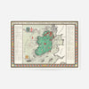
Irish Free State & Northern Ireland Map from 1929 By Macdonald Gil
- Regular Price
- £12.80
- Sale Price
- £12.80
- Regular Price
- £16.00
- Unit Price
- per


Add 4 21x30cm Prints to your cart, and we'll add 4 frames absolutely FREE!
This 1929 map captures a pivotal moment in Irish history, when the Free State had just established itself as an independent nation. Macdonald Gill's cartographic style brings warmth and character to the political boundaries of the time, with hand-illustrated detail that transforms what could be a dry administrative document into something genuinely engaging.
The colour palette sits somewhere between vintage charm and boho aesthetic—soft, earthy tones that work beautifully in contemporary interiors without feeling overly nostalgic. Whether you're drawn to vintage map prints for their geography, their history, or simply their visual appeal, this one delivers on all fronts.
Available in A4, A3, A2, A1, 50x70cm and 70x100cm on 230gsm fine art paper with archival pigment inks that resist fading for decades. Pair it with a solid wood frame in black, natural oak, white or gold ornate finishes, or leave it unframed to let Gill's hand-drawn detail shine. Dispatched from Newcastle and arriving rolled in a protective tube, this map works as a striking standalone statement or woven into a gallery wall arrangement.
- FREE DELIVERY OVER £60 / $75 / €70
- PREMIUM MATTE ART PAPER
- FADE-RESISTANT INKS
- NO FUSS RETURN POLICY
We ship with Royal Mail and aim to deliver our products to the UK within 2-5 working days. International orders will take a few days longer depending on the location.
Free UK Shipping on all orders over £60